 NOAA
NOAA
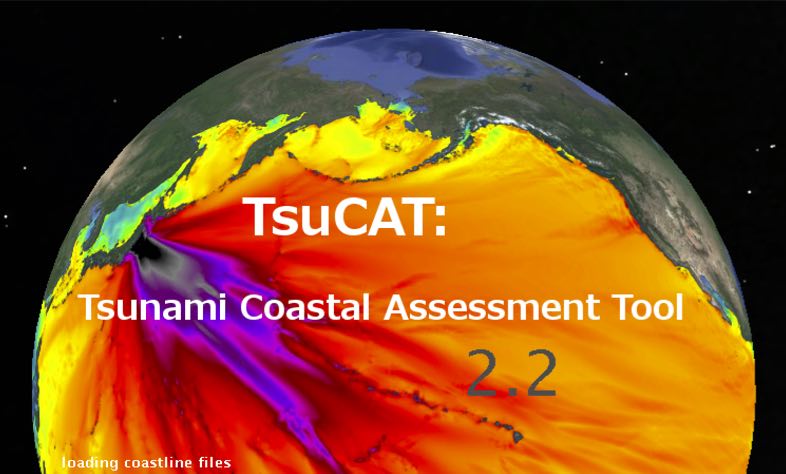
TsuCAT
Tsunami Coastal Assessment Tool (TsuCAT)
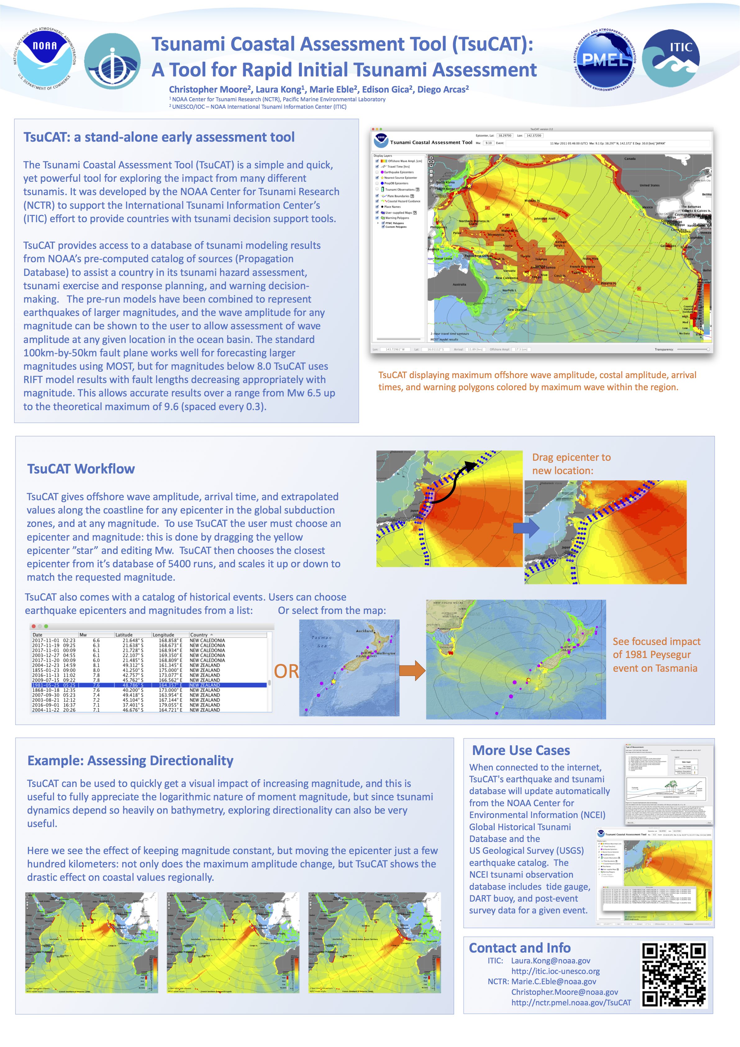
 The Tsunami Coastal Assessment Tool (TsuCAT) is a simple and quick, yet powerful tool for exploring the impact from many different tsunamis. It was developed by the NOAA Center for Tsunami Research (NCTR) to support the International Tsunami Information Center’s (ITIC) effort to provide countries with tsunami decision support tools.
 TsuCAT provides access to a global database (including Pacific, Caribbean, and Indian Ocean sources) of tsunami modeling results from NOAA’s pre-computed catalog of sources (Propagation Database, GICA et al., 2008), and from NOAA’s RIFT model, to assist a country in its tsunami hazard assessment, tsunami exercise and response planning, warning decision-making, and education and outreach. Simulations for historical tsunami sources from NOAA’s National Centers for Environmental Information (NCEI) and the U.S. Geological Survey earthquake archive are also included. The tool is a ‘standalone’ application not requiring the Internet, and can be used for outreach in remote locations, as well as during events when telecommunications are down.
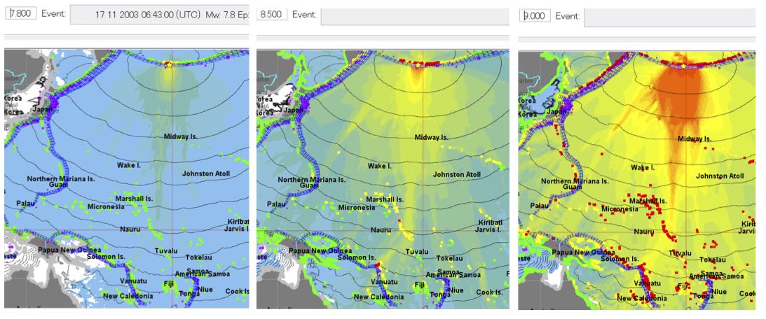
TsuCAT assists countries in response planning and preparedness by providing a tool that enables planners to determine where the worst case tsunami sources are located, how big the earthquake’s magnitude must be to directly threaten their coastlines, how much time they will have before the first tsunami wave hits, and how big the tsunami wave is expected to be. This information can then be used to develop tsunami emergency response and evacuation plans, and to conduct tsunami exercises that will prepare response agencies and communities to be ready for the real event. Tsucat v4 introduces an exercise tool will allow countries 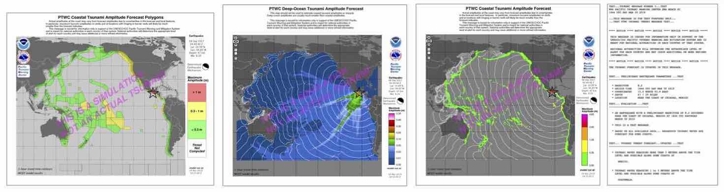 to choose their own scenario and conduct their own exercises using the PTWC public text and enhanced graphical products.
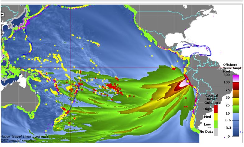 TsuCAT can also assist national tsunami warning centers with early situational awareness (approximate scenario) prior to the availability of event-specific forecasts from national agencies or international tsunami service providers. As TsuCAT is a pre-computed database of plausible tsunami scenarios with customizable coastal hazard warning polygons, it could be useful as a look-up tool to provide a conservative assessment prior to PTWC tsunami forecasts (typically 30 minutes after the earthquake due to the time required to reliably characterize the earthquake source).
Click to view TsuCAT overview and demonstration video
- WFO Guam, 26 Jan 2021
- FSM-Marshall Islands-Palau, 16 Feb 2021
- WSO Pago Pago, 24 Feb 2021 (coming soon)
Click to download TsuCAT Overview presentation, v4.2, October 2020 (15 MB)
Click to download TsuCAT Information Sheet, v4.2, October 2020 (832 KB)
Click to download TsuCAT poster: Tsunami Coastal Hazard Assessment Tool (TsuCAT) - Supporting National Efforts in Disaster Risk Reduction, International Union of Geodesy and Geophysics, July 2019 (13 MB)
Click to download TsuCAT poster: Tsunami Coastal Assessment Tool (TsuCAT): A Tool fo Rapid Initial Tsunami Assessment, IOC/UNESCO Symposium: Advances in Tsunami Warning to Enhance Community Responses, 12-14 February 2018, Paris, France (13 MB, below)
Additional information can also be found at
https://nctr.pmel.noaa.gov/TsuCAT/

![]()

Quick Links
![]()
![]()
![]()
Resources


Tsunami Awareness Poster
Available in English, Spanish, Chinese, French, Japanese, Korean, Portuguese, Singalese.

Global & Regional Hazard Maps
Tsunami Sources, Significant Earthquakes, Significant Volcanic Eruptions, Tsunami Icosohedron Globe.


TsunamiTeacher USA
Tsunami Basics
Also on YouTube
(w/closed captioning)
Learn the basics of tsunamis. Available in English, Samoan.