 NOAA
NOAA
4 March 2021 (UTC), Mw 8.1, Kermadec Islands, New Zealand Tsunami
Click here to download the Event Summary (PDF, 4.9 MB)
|
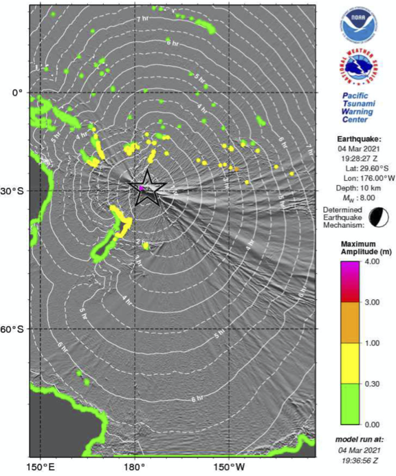
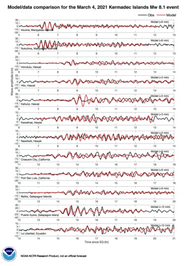
A 8.1 Mw earthquake occurred on 4th March 2021 at 19:28 UTC along the Tonga-Kermadec subduction zone north of New Zealand, triggering a tsunami that was observed locally and across the Pacific Basin. At the location of the earthquake, the Pacific plate moves westward relative to the Australia plate at a velocity of about 60 mm/yr, subducting to the west beneath the Australia plate at the Tonga and Kermadec Trenches. Maximum observed tsunami amplitudes reported by PTWC were 0.56 m at Norfolk Island west of the epicenter and 0.48 m in the Galapagos, Ecuador to the east northeast. On Raoul Island, the largest of the Kermadec Islands and close to the epicenter, data communication systems were knocked out by the earthquake, including for the sea level gauges that would have been used to confirm the severity of any tsunami from the Mw 8.1 earthquake. The earthquake occurred as the result of reverse faulting in the Tonga-Kermadec subduction zone at a depth of ~29 km. It was preceded by a Mw 7.4 located ~50 km to the west ~107 minutes earlier. The proximity and timing of the two events indicates that the M 7.4 was likely a foreshock of the M 8.1 earthquake. In terms of seismic moment, the Mw 8.1 was ~11 x larger than the Mw 7.4 foreshock. A Mw 7.3 earthquake also occurred six hours earlier ~900 km to the south, but the spatial and temporal gap between them make it unlikely the M 7.3 was a direct cause of the Mw 7.4 or Mw 8.1 earthquakes. The three earthquakes were all captured on the New Zealand DART network. Tsunami waves arrived in ~20 minutes and were recorded at stations NZE and NZG. Processed data was available about an hour after the tsunami origin. These direct observations of the Mw 8.1 tsunami supported better forecasting, including 1) reducing uncertainties in maximum wave amplitude and 2) reducing modeling uncertainties in the duration of tsunami threat. |
Top: Regional tectonics and seismicity Mw 7 or greater, colored by depth. The epicenter of the March 2021 Mw 8.1 earthquake is shown by the yellow star. Bottom: Geographic setting near the Mw 8.1 earthquake (yellow star). The Mw 7.4 foreshock was located at the orange dot. |


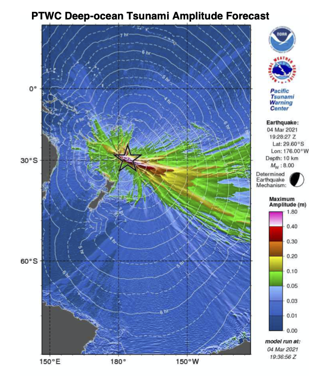
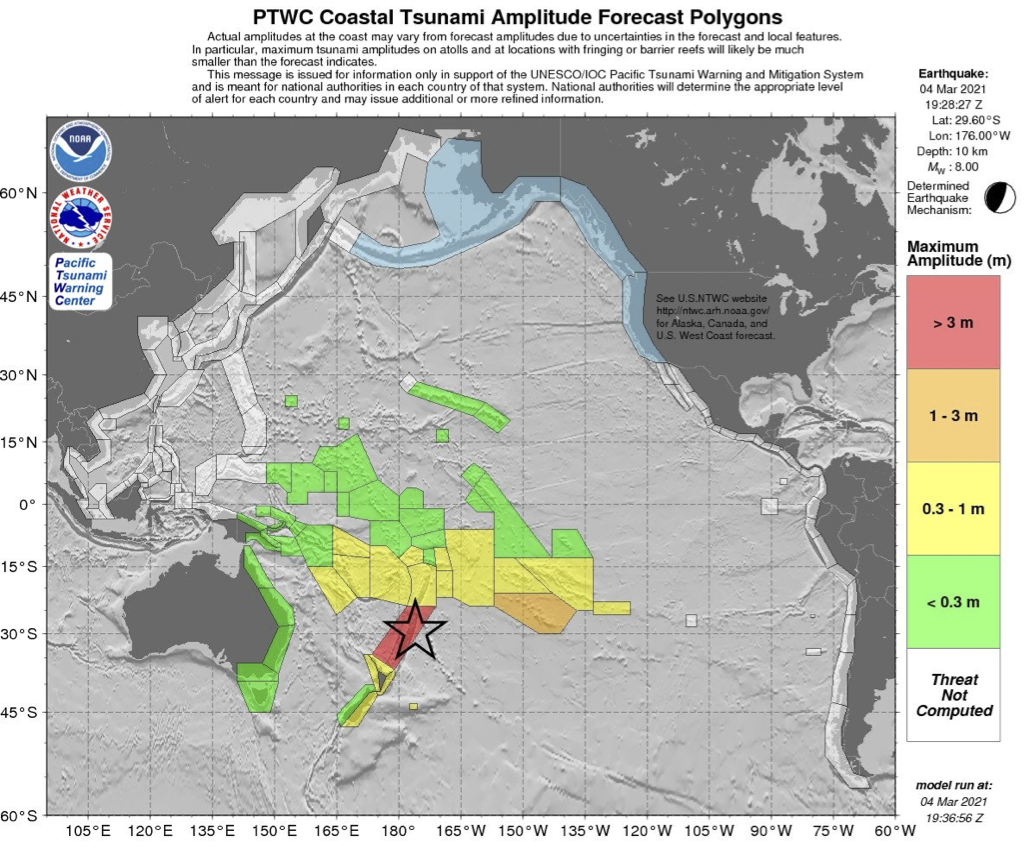
PTWC’s forecast of maximum tsunami amplitude by regional polygons, based on the Real-time Inundation Forecast of Tsunamis (RIFT) model for the Mw 8.1 earthquake on 4 March 2021 near the Kermadec Islands. The model was run at 19:37 GMT, 4 March 2021, 9 minutes after the earthquake.

![]()

Quick Links
![]()
![]()
![]()
Resources


Tsunami Awareness Poster
Available in English, Spanish, Chinese, French, Japanese, Korean, Portuguese, Singalese.

Global & Regional Hazard Maps
Tsunami Sources, Significant Earthquakes, Significant Volcanic Eruptions, Tsunami Icosohedron Globe.


TsunamiTeacher USA
Tsunami Basics
Also on YouTube
(w/closed captioning)
Learn the basics of tsunamis. Available in English, Samoan.