 NOAA
NOAA
2011 Japan Tsunami - Before/After Photos of Ishinomaki, Miyagi
Ishinomaki, located in Miyagi Prefecture, Honshu, was one of the worst communities hit. Tsunami waves up to 10 m flooded up to five km inland inundating nearly 15% of the city. The earthquake caused the land to subside up to 1.2 m, resulting in additional flooding at high tide in some areas. More than 50,000 homes and buildings were destroyed by the tsunami, erasing a once-vibrant city center, and much of its seaport and land transportation infrastructure was leveled. Nearly 3100 lost their lives and 2800 are still missing.
Ishinomaki before and after the 2011 Great East Japan tsunami
To view and/or download the high resolution files below, click on the images.
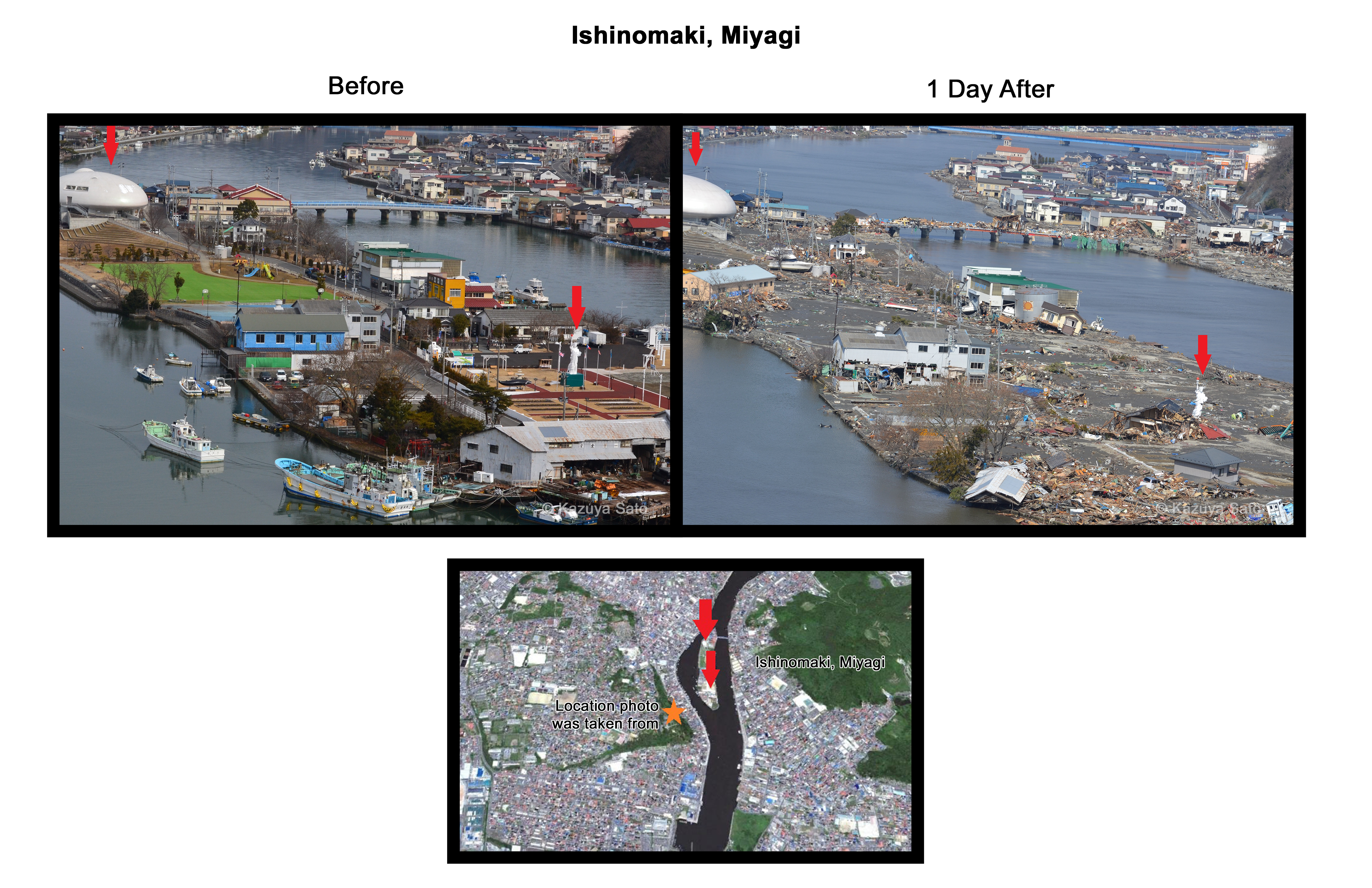
Nakaze district, Ishinomaki
The Nakaze district is a sand bank on the Kyu-Kitakami River located two miles inland from the Pacific Ocean. 5.9m was the maximum tsunami runup was 5.9 m. Washed away were the Ishinomori-Manga-Museum, a theater, the Ishinomaki Orthodox Church cathedral (completed in 1880), and shipyards. Red arrows point to identical places in each photo.
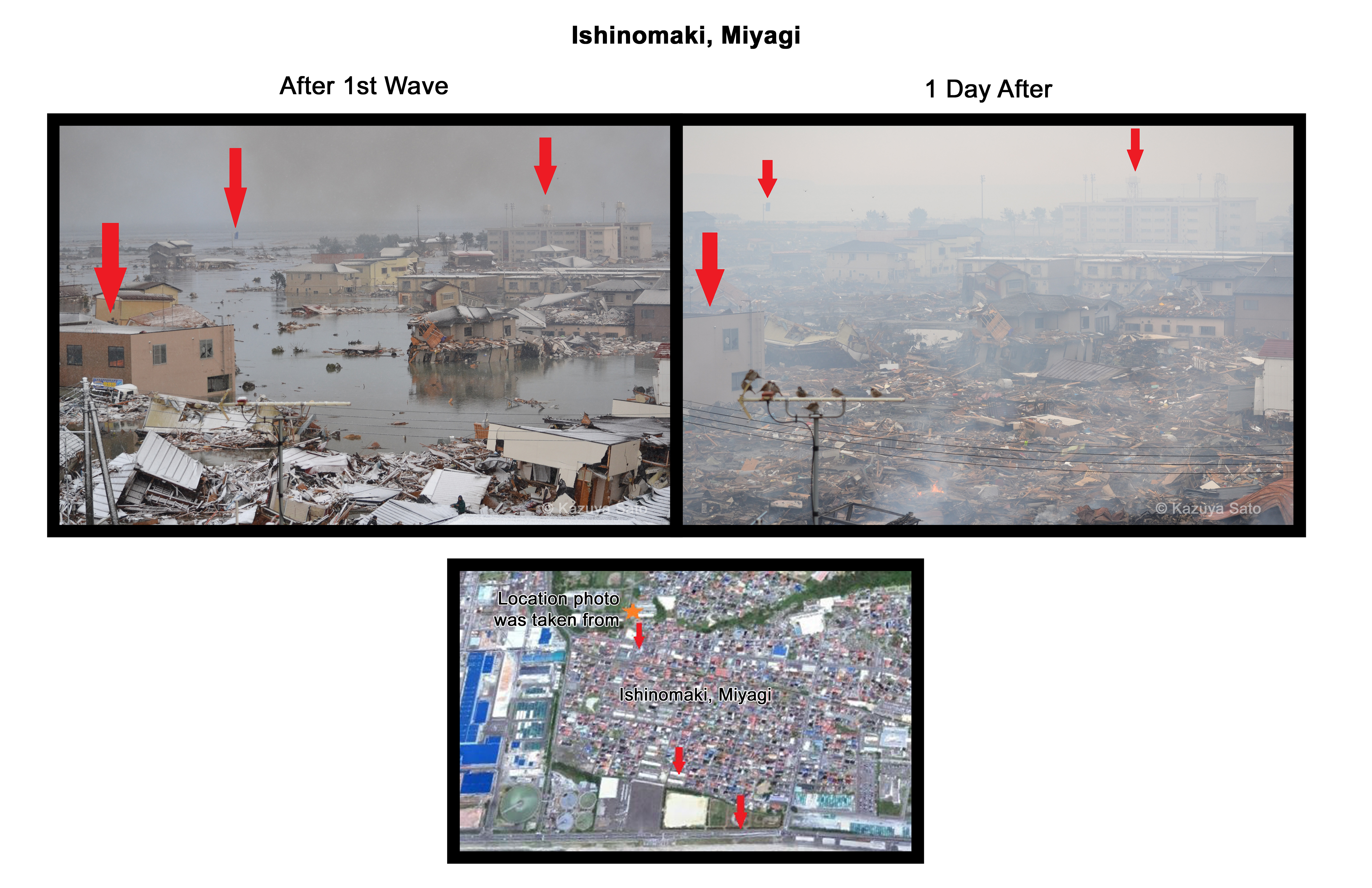
Minamihama district, Ishinomaki
The Minamihama district is a coastal area facing the Pacific Ocean. The maximum tsunami runup was 6.7m. Prior to the tsunami, there were many residences in this area. During the tsunami, leaking oil from flooded cars caused a large fire, adding to the widespread damage. The total number of dead or missing was over 400 in this area.
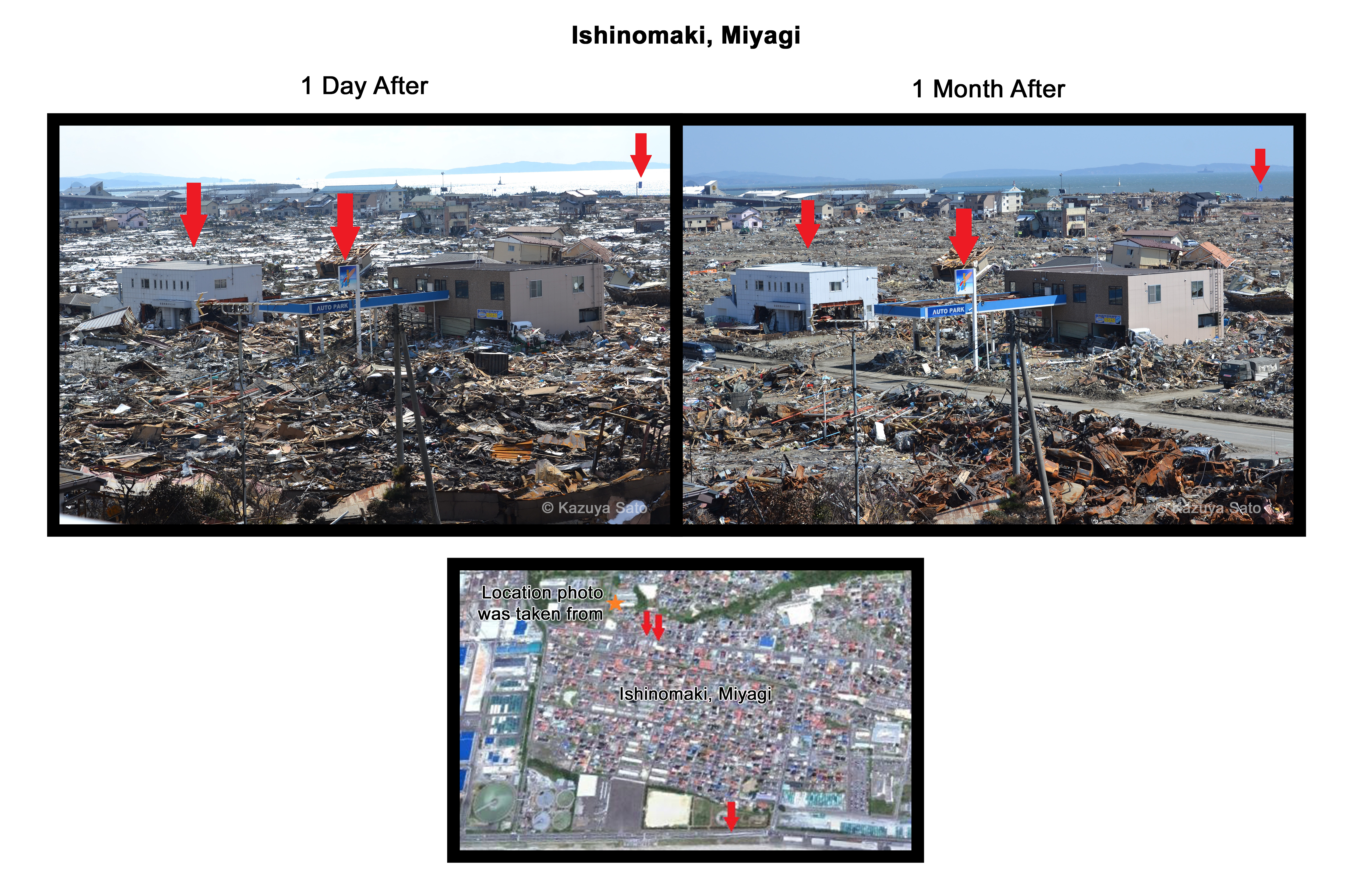
The photos below show the city before and three weeks after the tsunami. The Ishinomaki city hospital (left red arrow) and the Ishinomaki city cultural center (right red arrow) both survived the tsunami but most other structures did not.


![]()

Quick Links
![]()
![]()
![]()
Resources


Tsunami Awareness Poster
Available in English, Spanish, Chinese, French, Japanese, Korean, Portuguese, Singalese.

Global & Regional Hazard Maps
Tsunami Sources, Significant Earthquakes, Significant Volcanic Eruptions, Tsunami Icosohedron Globe.


TsunamiTeacher USA
Tsunami Basics
Also on YouTube
(w/closed captioning)
Learn the basics of tsunamis. Available in English, Samoan.