 NOAA
NOAA
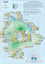
Hawaii Tsunami Awareness Month - April 2016
Browse our Hawaii tsunami informational materials, see below.
Click image to download PDF.
|
|
|
Click for more Hawaii information.
Download Hawaii Historical Tsunami Effects poster (NCEI, ITIC). 7. 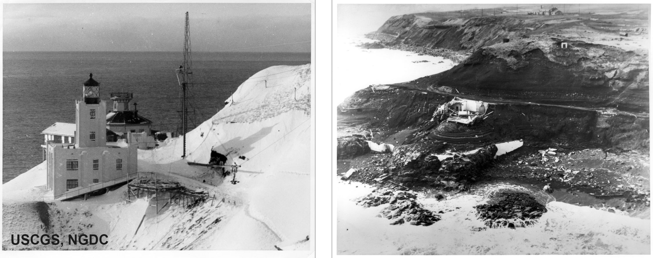
This year is the 70th anniversary of the Mw8.6 April 1, 1946 Aleutian Island earthquake and tsunami. Until then, no one in the US would have imagined that a U.S. Coast Guard lighthouse tens of meters above sea level could be completely destroyed by a tsunami. Yet this is exactly what happened on April Fool’s Day – tsunami waves surged to 42-meter elevation at Scotch Cap about 48 minutes after the earthquake. All five lighthouse crew members were killed. The earthquake, initially assigned a magnitude of 7.4, was also one of the first earthquakes to be identified as a “tsunami earthquake,” as it had an exceptionally slow rupture and hence lower high-frequency seismic amplitudes.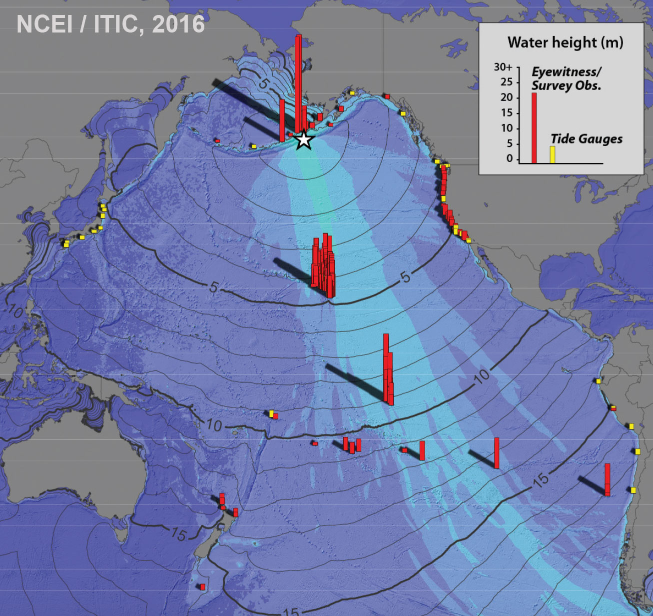 In the far-field, the tele-tsunami was observed across the Pacific basin, and was especially destructive in Hawaii, where 17-meter waves killed 158 people statewide. Six to seven waves every 15-20 minutes pounded Hilo town on the island of Hawaii, causing heavy damage (USD $26 million), and 96 deaths.
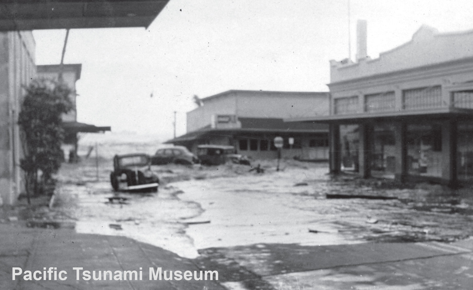
To remember and sustain its readiness over time, Hawaii designated April as Tsunami Awareness Month in the 1990s. It continues today with tsunami partners at the federal, state, and local levels working together to ensure public preparedness.
The devastating effects, and the fact that high-frequency ground shaking could not be used as a natural warning sign, led the U.S. Coast and Geodetic Survey to install an earthquake alarm system to notify the staff at any hour of the day. Tsunami travel time maps were completed to quickly determine Hawaii arrival times from Pacific sources. A communication plan was put into place for receiving seismic data from multiple Coast and Geodetic Observatories to locate the earthquake, and for receiving tsunami observations from tide station observers around the Pacific to confirm a tsunami.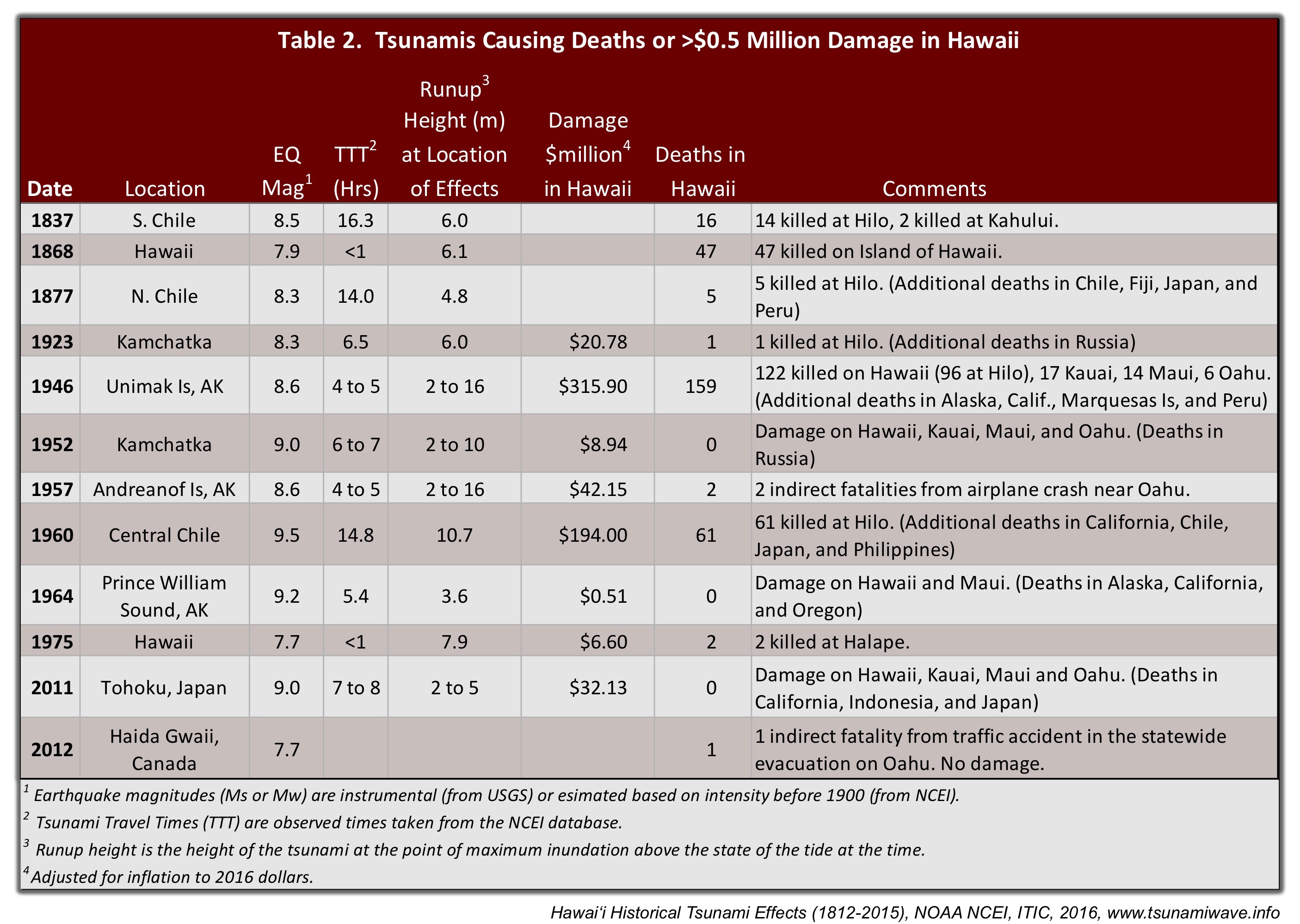 The U.S. Seismic Sea Wave Warning System started on August 12, 1948 at the Honolulu Observatory. The system was able to determine a tsunami’s severity before it hit Hawaii, and therefore provide warnings, or cancel watches before actual evacuations had to take place. The SSWWS was in action soon after as destructive tsunami hit the Hawaiian Islands in 1952 (Kamchatka), 1957 (Andreanof Islands), 1960 (Chile), and 1964 (Prince William Sound).
In 1965, the International Tsunami Warning System in the Pacific (ITSU, now PTWS) was established in response to the M9.5 Chile earthquake, and the US offered to expand its tsunami services to include the Pacific. Today, the PTWC provides tsunami warnings for the state of Hawaii, as well as other US insular interests in the Pacific and Caribbean, and serves as a Tsunami Service Provider issuing timely international threat information to Pacific and Caribbean countries.

![]()

Quick Links
![]()
![]()
![]()
Resources


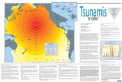
Tsunami Awareness Poster
Available in English, Spanish, Chinese, French, Japanese, Korean, Portuguese, Singalese.

Global & Regional Hazard Maps
Tsunami Sources, Significant Earthquakes, Significant Volcanic Eruptions, Tsunami Icosohedron Globe.


TsunamiTeacher USA
Tsunami Basics
Also on YouTube
(w/closed captioning)
Learn the basics of tsunamis. Available in English, Samoan.