 NOAA
NOAA
08 September 2017, Mw 8.2, Offshore Chiapas, Mexico Tsunami
Click here to download the Event Summary (PDF, 9.9 MB)
|
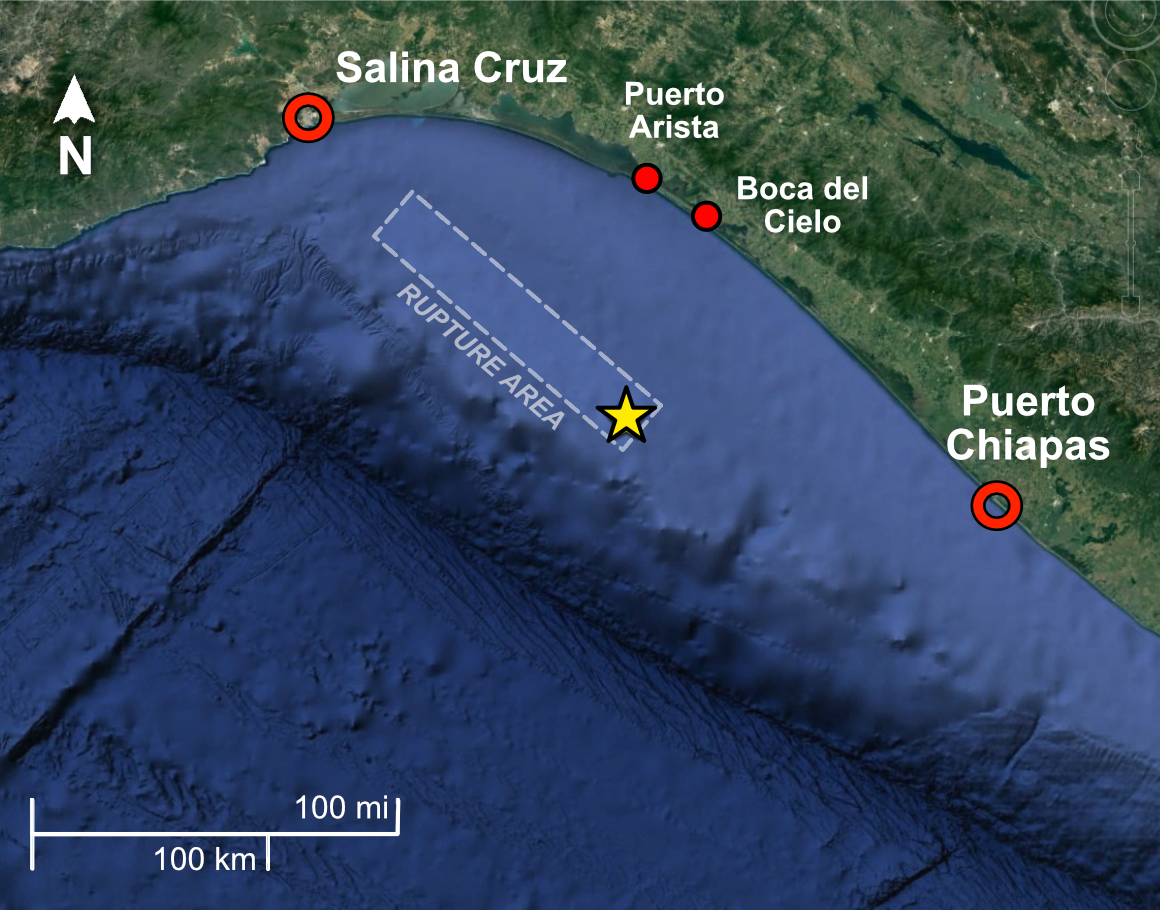
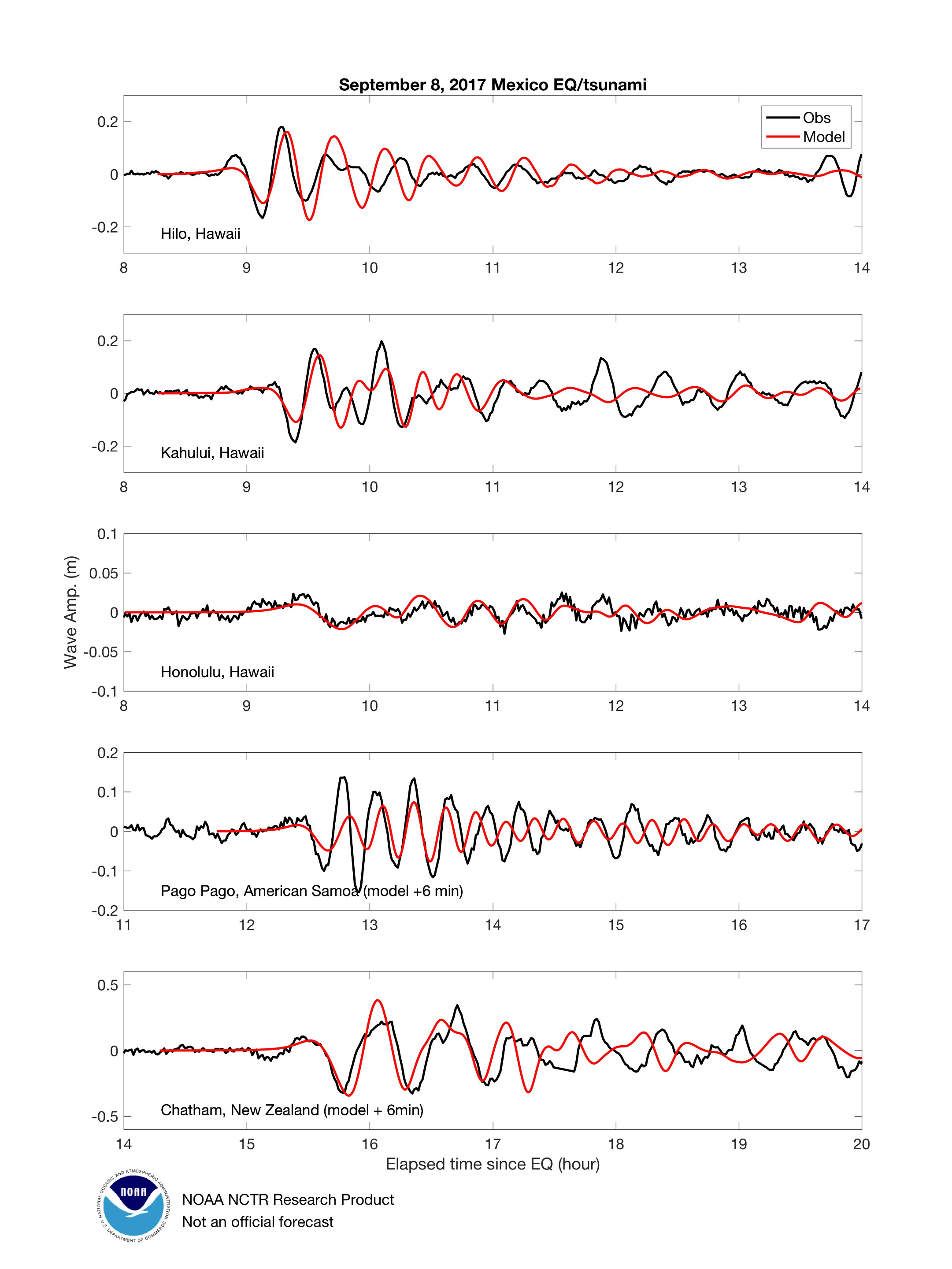
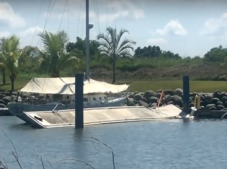
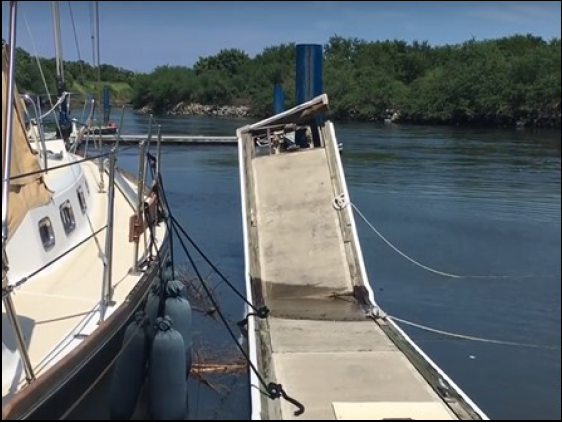
On 8 September 2017 at 04:49 UTC a tsunami was triggered by a Mw 8.2 earthquake that struck offshore Chiapas, Mexico. It was the largest earthquake in the Chiapas area since 1902. Tide gauge data showed 11.3 and 8.2 cm of coastal subsidence at Salina Cruz and Puerto Chiapas stations respectively. The maximum runup was ~3 m at Boca del Cielo, and maximum inundation distance was 190 m in Puerto Arista, corresponding to the coast directly opposite the rupture area. The earthquake occurred as the result of normal faulting at an intermediate depth of 47 km. At the location of this event, the Cocos plate converges with the North American plate in a northeast direction at a rate of approximately 76 mm/yr. The Cocos plate begins its subduction at the Middle America Trench, approximately 100 km to the southwest of this earthquake. Although the epicenter and rupture zone of the earthquake were beneath the overriding North American continental plate, the depth and normal-faulting mechanism indicate that it was likely a rupture on an intraplate fault, within the subducting Cocos oceanic plate, rather than on the shallower interplate megathrust interface.  |
Top: Regional tectonics and seismicity Mw 5.5 or greater. The epicenter of the September 2017 Mw 8.2 earthquake is shown by the yellow star. Bottom: Geographic setting of the earthquake. |


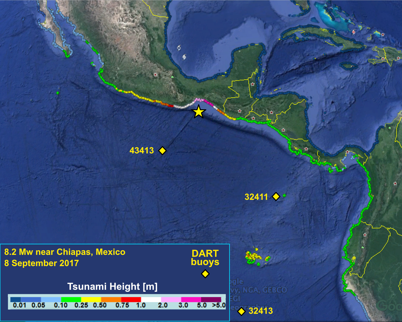
Coastal Amplitude Forecasts
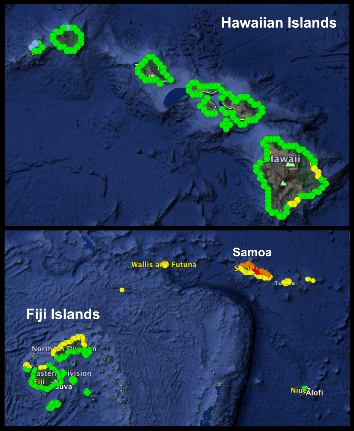 |
Forecast coastal tsunami amplitudes from the PTWC Realtime Forecast of Tsunamis (RIFT) model. |
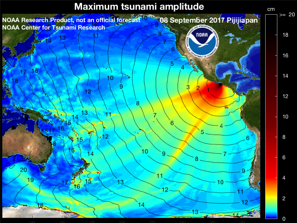
Maximum tsunami amplitude (centimeters) from MOST model.
Travel time in hours shown by black contour lines. (NOAA Center for Tsunami Research)
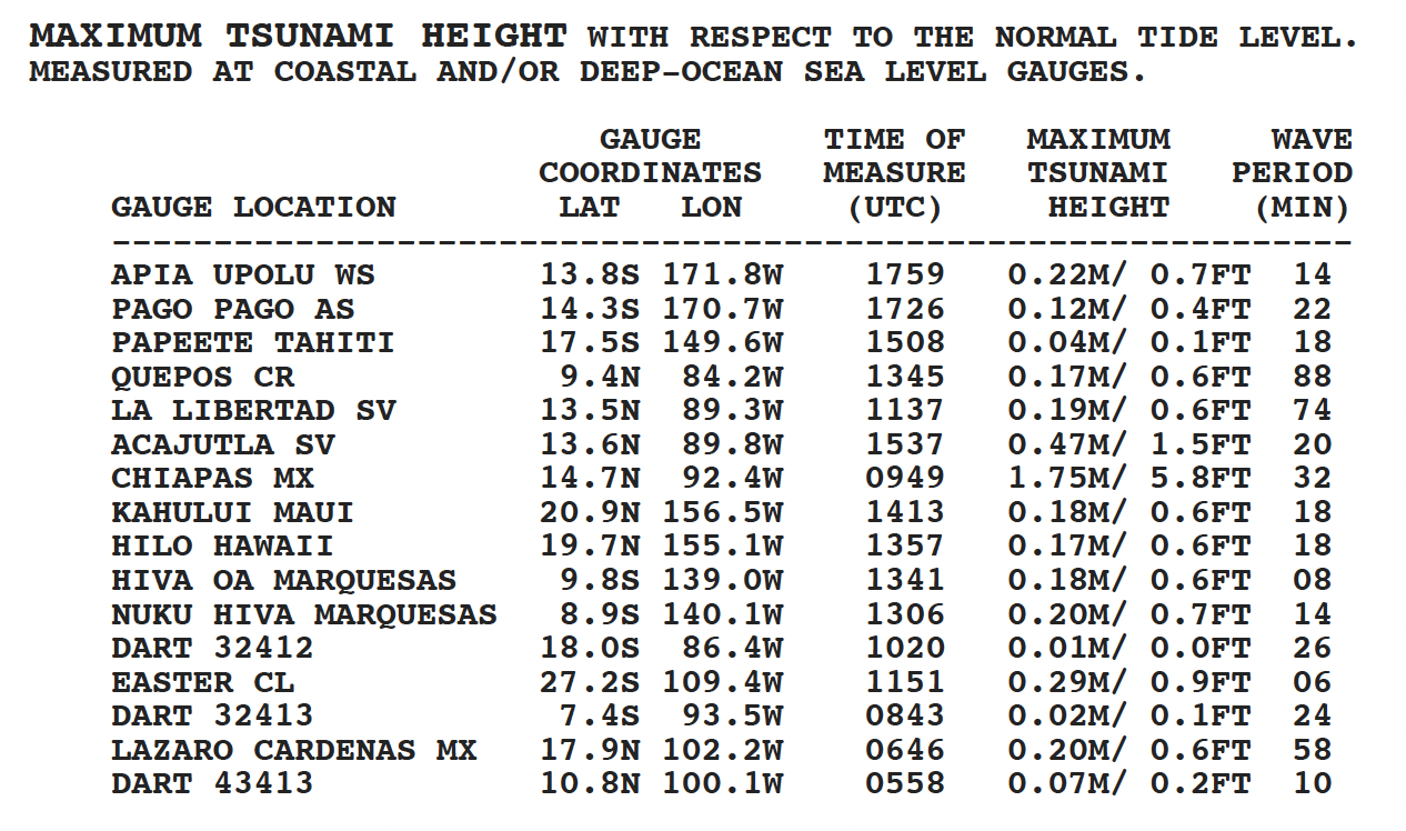
Nearby Tide Gauge Records
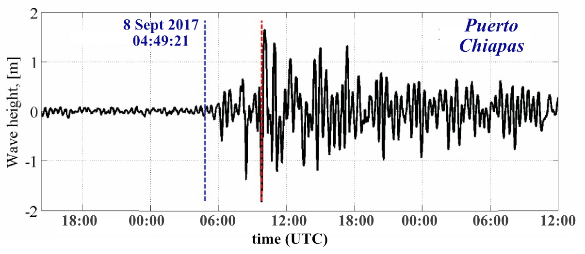

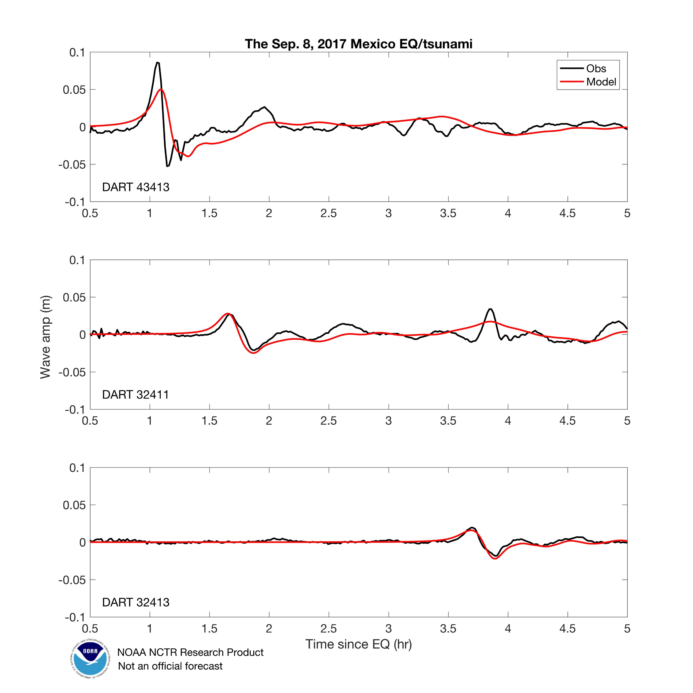
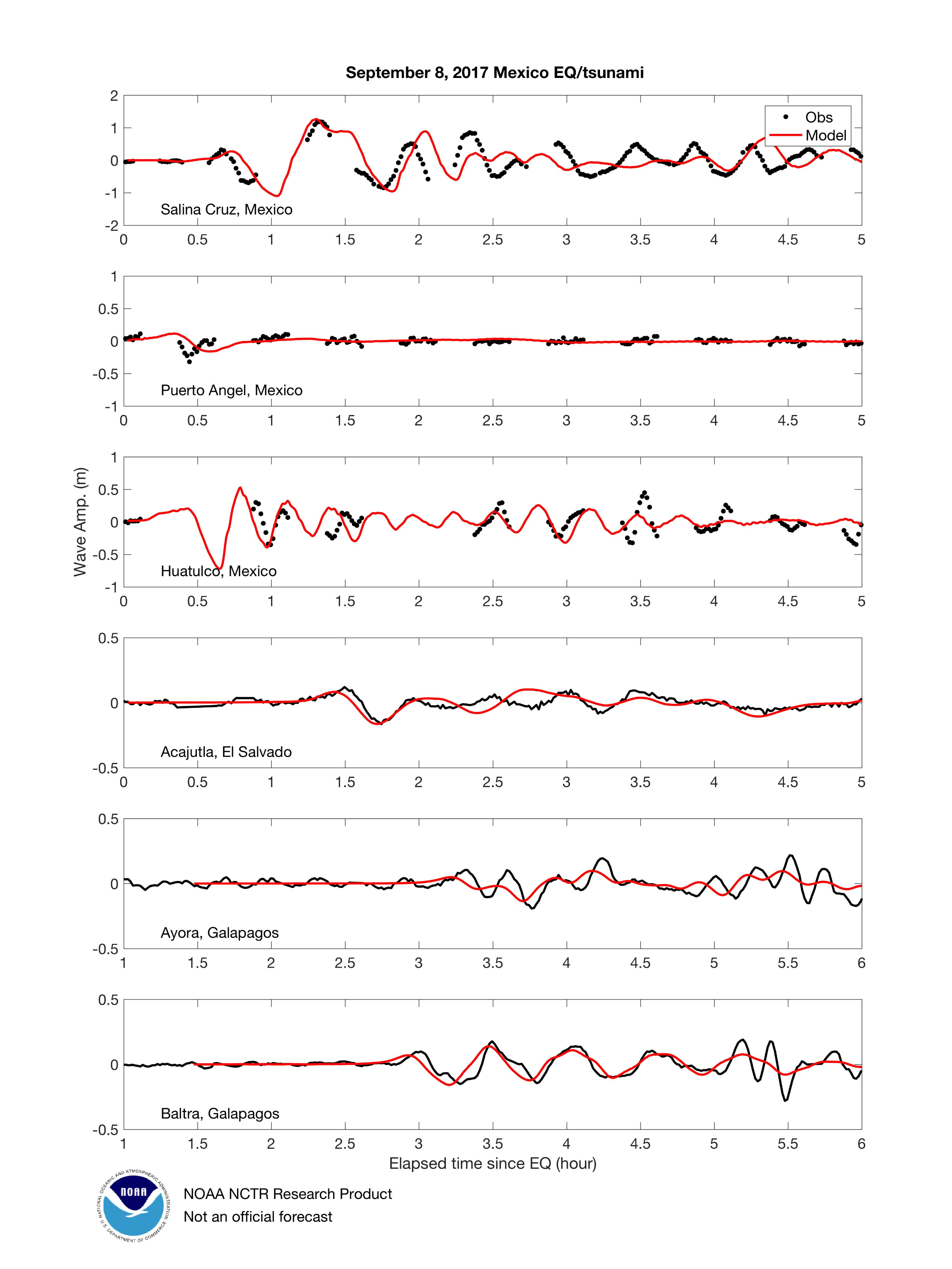
Sea Level Records, DART buoys
see Coastal Amplitude Forecasts map for locations
Pacific Coastal Tide Gauge Records

![]()

Quick Links
![]()
![]()
![]()
Resources


Tsunami Awareness Poster
Available in English, Spanish, Chinese, French, Japanese, Korean, Portuguese, Singalese.

Global & Regional Hazard Maps
Tsunami Sources, Significant Earthquakes, Significant Volcanic Eruptions, Tsunami Icosohedron Globe.


TsunamiTeacher USA
Tsunami Basics
Also on YouTube
(w/closed captioning)
Learn the basics of tsunamis. Available in English, Samoan.