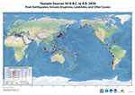
12 December 1992, Mw 7.7, Flores, Indonesia
An earthquake of magnitude 7.7, with epicenter about 35 km NW off the north coast of the eastern part of Flores Island - near itslargest city Maumere - generated a local tsunami which killed 1690 people and destroyed approximately 18,000 houses. The first tsunami wave arrived on the shores of Flores Island within two minutes after the initial shock and reached the north shore within five minutes. Huge tsunami waves with runup of up to 26.2 m completely overrun and destroyed Riang-Kroko, a small village at Cape of Watupajung at the extreme NE end of Flores Island, killing 137 people. Offshore landslides, triggered by the earthquake, may have contributed to the enormous size of the waves which struck this village.
| Seismic and Geodetic |
|
| Data and Information Sites |
|
 NOAA
NOAA


